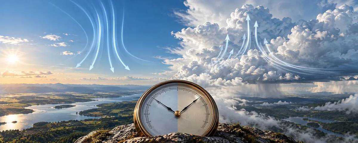
A high or low is a relative pressure pattern
A pressure system is not defined by one universal number. A high is an area where pressure is higher than nearby surroundings; a low is lower than nearby surroundings. Meteorologists find these patterns by comparing many corrected barometer readings on a map.
Surface pressure is commonly reduced to mean sea level before mapping so station elevation does not overwhelm the weather signal. A mountain station naturally has lower measured pressure because less air lies above it. The barometric pressure guide explains station pressure, sea-level pressure and why a single home reading needs context.
Why highs often clear and lows often cloud over
Air generally sinks through a high-pressure system. As sinking air enters higher pressure closer to the surface, it compresses and warms. Its relative humidity often falls, which makes widespread cloud formation less likely. That is why highs are commonly associated with fair weather, light winds near the center and larger day-to-night temperature swings under clear skies.
Near a surface low, air converges and rises. Rising air expands and cools. If it cools to saturation, water vapor condenses into cloud droplets and precipitation may develop. Low pressure supports clouds and storms, but a low does not guarantee rain at every point. Available moisture, lift, stability and the system's path still matter.
Pressure pattern, not pressure alone, drives the wind
| Map feature | Airflow tendency | Common clue | Important limit |
|---|---|---|---|
| Broad high | Sinking and spreading | Often clearer and calmer | Fog or trapped pollution can still occur |
| Deep low | Converging and rising | Clouds, wind and possible precipitation | Moisture and stability control the outcome |
| Tightly packed isobars | Strong pressure-gradient force | Stronger wind likely | Friction and terrain alter surface wind |
| Weak gradient | Smaller pressure force | Lighter wind likely | Local sea or mountain breezes may dominate |
Rotation changes between hemispheres
Air starts accelerating from higher toward lower pressure, but Earth's rotation deflects moving air. Around surface lows, flow is generally counterclockwise in the Northern Hemisphere and clockwise in the Southern Hemisphere. Around highs, the directions reverse. Friction slows wind near the surface and lets it cross isobars toward lower pressure.
Do not use the rotation rule as a claim about a single gust. Buildings, valleys, coastlines and thunderstorms can redirect local wind. The rule describes the broader circulation. Convert forecast units with the wind speed converter when comparing knots, mph, km/h and m/s.
Fronts commonly organize around lows
Midlatitude low-pressure systems often connect to warm and cold fronts. A front marks a boundary between air masses with different properties. The low provides broad circulation and lift; the front concentrates changes in temperature, wind and moisture. A cold front commonly extends south or southwest from a Northern Hemisphere low, while a warm front extends ahead of it.
A high can follow behind a front as cooler, drier air spreads into the region. The sequence may be rising pressure, clearing cloud and easing precipitation, but timing depends on the system. The barometric pressure guide shows how the passing pattern appears in a local pressure trace.
Read pressure tendency with current conditions
Rising pressure often suggests a low or front is moving away and a high is approaching. Falling pressure can signal an approaching low. The trend is useful, but it is not a standalone forecast. A slowly falling barometer under moist, strengthening wind tells a different story from a small pressure change during a daily heating cycle.
- Compare the reading with nearby official stations.
- Check whether the display uses station pressure or sea-level pressure.
- Watch the change over several hours.
- Pair the trend with wind, cloud and radar.
- Use official watches and warnings for safety decisions.
A home barometer can reveal the passage of systems, but it cannot show the full pressure field by itself.